
Phoenix, Arizona, January 9, 2026
Arizona, California, and Wisconsin are currently experiencing multiple weather alerts due to a severe storm system. Phoenix is under a Wind Advisory and Freeze Warning, while Southern California faces historic rainfall and strong winds, causing flooding. Wisconsin is on Flood Watch and Winter Weather Advisory due to heavy rainfall and potential snow. Residents are advised to take precautions in all affected regions.
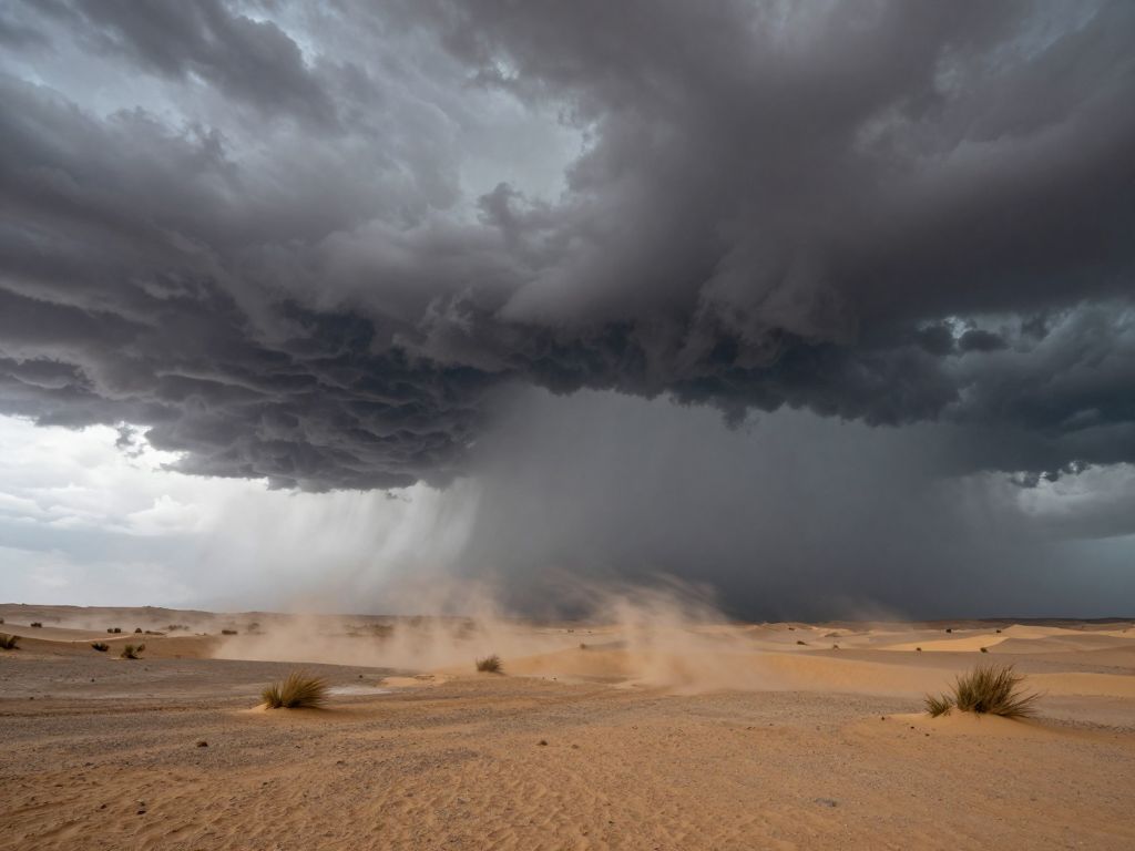
Phoenix, Arizona
Multiple weather alerts have been active across Arizona, California, and Wisconsin over the past 48 hours, with residents in affected areas advised to take precautions against strong winds, freezing temperatures, and potential flooding. Phoenix, Arizona, has been under a Wind Advisory and a Freeze Warning, while parts of Southern California experienced historic rainfall, high wind warnings, and dense fog. Meanwhile, Wisconsin faced a Flood Watch and Winter Weather Advisories.
A Wind Advisory was issued for Phoenix, Arizona, from January 8 at 12:24 PM MST until January 9 at 1:00 PM MST. North winds of 20 to 30 mph were expected. Additionally, a Freeze Warning was in effect for parts of Arizona, including the Parker Valley, from midnight Friday night (January 9) to 9 AM MST Saturday (January 10), with sub-freezing temperatures in the lower 30s anticipated. Rural and low-lying areas, particularly in north-central and northwest Maricopa County and higher zones east of Phoenix, were expected to experience freezing temperatures Friday and Saturday mornings. These cold conditions followed a cold front that swept through the area on January 8, bringing chances for showers and isolated thunderstorms, and regionally breezy conditions with cooler temperatures. Winds were expected to be stronger out west, with gusts locally exceeding 40 mph during the evening, overnight, and early Friday morning hours. Temperatures in Phoenix were forecast to be in the low 60s on January 9, with overnight lows dropping into the 30s and low 40s in urban areas. The National Weather Service in Phoenix also issued a Dense Fog Advisory on January 8, effective until January 10 at 10:00 AM MST, for areas including Southeastern Imperial County, Kofa, Yuma, and Gila River Valley. This advisory warned of visibility between one-quarter and one-half mile, making driving hazardous. Residents were advised to slow down, use headlights, and maintain ample distance while driving. Following these weather events, temperatures in Phoenix are expected to warm to near or above normal by Sunday and remain in an above-normal category during the upcoming work week, with dry conditions prevailing across the region through at least the middle of next week.
California’s Historic Rainfall and Strong Winds
Southern California has experienced a period of significant weather activity, including historic rainfall and strong winds. San Diego recorded over 3 inches of rain between January 1 and 5, 2026, marking the highest total for the first five days of January since 1939. This unprecedented precipitation led to widespread flooding and power outages across the region.
Wind Advisories and High Wind Warnings in California
Multiple wind advisories and warnings were in effect for various parts of California. A Wind Advisory was issued by NWS San Diego CA on January 8, effective from 12:59 PM PST until January 11 at 1:00 PM PST for the Santa Ana Mountains and Foothills, and Orange County Inland Areas, with northeast winds of 15 to 25 mph and gusts between 35 and 45 mph expected. Strongest winds were anticipated east of Interstate 5 and near the foothills of the Santa Ana mountains. This advisory warned of gusty winds that could blow around unsecured objects, potentially leading to downed tree limbs and power outages. An earlier Wind Advisory was also issued by NWS San Diego CA on January 8 at 2:03 AM PST, expiring at 1:00 PM PST, forecasting west winds of 20 to 30 mph with gusts of 40 to 50 mph in areas including Apple and Lucerne Valleys, Coachella Valley, and San Diego County Deserts.
A High Wind Warning was in effect for the San Bernardino County Mountains from January 8 at 10:00 AM to January 10 at 1:00 PM, with predictions of north winds of 20 to 30 mph and gusts up to 70 mph near the Cajon Pass. The strongest winds were expected on coastal slopes and mountain foothills. Due to recent heavy rains and saturated soils, there was an increased risk of fallen trees and power outages. Travelers, particularly in areas below the Cajon Pass, were urged to exercise caution. Additionally, a Small Craft Advisory was in effect from January 8 at 10:17 AM PST for San Diego, remaining effective from 7 AM. San Diego County Coastal Areas were forecast to experience northwest winds of 10 to 15 mph with gusts up to 35 mph, becoming northeast with gusts up to 30 mph overnight into January 9. Inland valleys of San Diego County also expected northeast winds of 10 to 20 mph with gusts up to 30 mph overnight on January 8, increasing to 25 to 35 mph with gusts up to 60 mph on January 9, and then 20 to 30 mph with gusts up to 50 mph on January 10.
Wisconsin Under Flood Watch and Winter Weather Advisory
In Wisconsin, Door County was under a Flood Watch issued on January 8 at 10:39 AM CST until January 9 at 12:00 PM CST by the National Weather Service. This alert was part of a broader hazardous weather outlook for portions of east central, south central, and southeast Wisconsin. Moderate to heavy rainfall over partially frozen ground was expected to result in ponding water and minor flooding in low-lying areas, poor drainage areas, and roadways, particularly across central Wisconsin counties during the evening commute of January 8. Rain and mild temperatures were also expected to cause ice breakup along rivers, with a potential for ice jams around bridges and river bends, possibly leading to minor river flooding.
Furthermore, a Winter Weather Advisory was issued for Oneida, Vilas, Florence, and Forest Counties in far northern Wisconsin, effective from January 8 at 9:00 PM CST to January 9 at 6:00 AM CST. This advisory warned of mixed precipitation transitioning to all snow, with total snow accumulations of 2 to 4 inches expected, and localized amounts up to 6 inches possible depending on when the rain converted to snow. Slippery road conditions were anticipated, impacting the Friday morning commute. Across central and east-central Wisconsin, 1 to 2 inches of rain were expected, which could lead to minor urban and low-land flooding.
A major storm system was expected to impact millions across the United States starting January 8. This system was forecast to bring severe weather to parts of the central U.S. and Deep South, with a potential for flash flooding developing across the Tennessee Valley on January 9. The storm was projected to move from the Southwest into the Midwest, bringing heavy rain and severe thunderstorms. Areas in Oklahoma and Texas were expected to experience damaging wind gusts and hail, with the storm then spreading across Illinois, Wisconsin, and Indiana, reaching the Ohio Valley by evening. The National Oceanic and Atmospheric Administration (NOAA) issued a Level 2 out of 5 risk for severe thunderstorms, affecting over eight million people in the Lower Mississippi and Tennessee valleys, including Memphis, Tennessee, Jackson, Mississippi, and Baton Rouge, Louisiana, where damaging winds, hail, and possible tornadoes were a concern.
National Weather Overview
Nationwide, the beginning of January 2026 has been marked by a dynamic weather pattern. An “atmospheric river” event recently brought above-normal precipitation to several sectors of the Northwest and West U.S., including northwestern Arizona. However, snow-to-water equivalent in these regions was mostly below normal due to milder air during the atmospheric river event. The outlook for spring indicates significant drought potential for the southeast quadrant of the U.S..
Air quality across Wisconsin was generally good to moderate, with southerly flow ahead of an approaching system expected to bring widespread precipitation. Moderate particulate matter (PM2.5) levels were forecast statewide, with trends toward good air quality as the system moved through. However, increasing PM2.5 concentrations were possible later on Friday into Saturday morning as winds briefly stagnated.
Preparedness and Safety
Authorities urge residents in all affected areas to remain vigilant and take necessary safety precautions. This includes securing loose outdoor objects in windy conditions, protecting vulnerable plumbing from freezing temperatures, and exercising extreme caution when driving, especially in areas with dense fog, heavy rain, or icy roads. Monitoring local weather updates from the National Weather Service is crucial for staying informed about changing conditions and specific safety recommendations.
Frequently Asked Questions
- What weather advisories are currently active in Phoenix, Arizona?
- Phoenix, Arizona is under a Wind Advisory, which was issued January 8 at 12:24 PM MST until January 9 at 1:00 PM MST. Additionally, a Freeze Warning is in effect for rural and low-lying areas, including the Parker Valley, from midnight Friday night (January 9) to 9 AM MST Saturday (January 10). A Dense Fog Advisory was also issued on January 8, effective until January 10 at 10:00 AM MST, for Southeastern Imperial County, Kofa, Yuma, and Gila River Valley.
- What were the impacts of rainfall in Southern California?
- San Diego experienced historic rainfall, with over 3 inches recorded between January 1 and 5, 2026, the highest total for the first five days of January since 1939. This led to widespread flooding and power outages across the region.
- Which areas in California are under a High Wind Warning?
- A High Wind Warning is in effect for the San Bernardino County Mountains from January 8 at 10:00 AM to January 10 at 1:00 PM, with north winds of 20 to 30 mph and gusts up to 70 mph near the Cajon Pass.
- What is the current flood situation in Wisconsin?
- Door County, Wisconsin, is under a Flood Watch issued on January 8 at 10:39 AM CST until January 9 at 12:00 PM CST. This watch, alongside a broader hazardous weather outlook, indicates that moderate to heavy rainfall over partially frozen ground may cause ponding water and minor flooding in low-lying areas, poor drainage areas, and roadways across central Wisconsin. There is also a potential for ice jams and minor river flooding due to ice breakup along rivers.
- Are there any winter weather alerts for northern Wisconsin?
- Yes, a Winter Weather Advisory was issued for Oneida, Vilas, Florence, and Forest Counties in far northern Wisconsin, effective from January 8 at 9:00 PM CST to January 9 at 6:00 AM CST, expecting mixed precipitation changing to snow, with accumulations of 2 to 4 inches and localized amounts up to 6 inches.
Summary of Weather Alerts (January 8-9, 2026)
| Region | Alert Type | Key Details | Duration | Impacts |
|---|---|---|---|---|
| Phoenix, Arizona | Wind Advisory | North winds 20-30 mph. | Jan 8, 12:24 PM MST – Jan 9, 1:00 PM MST | Breezy conditions, cooler temperatures. |
| Phoenix, Arizona (Rural & Low-Lying Areas, Parker Valley, parts of Maricopa County) | Freeze Warning | Sub-freezing temperatures in the lower 30s. | Jan 9, Midnight MST – Jan 10, 9:00 AM MST | Potential for pipe fracture, damage to unprotected outdoor plumbing. |
| Southeastern Imperial County, Kofa, Yuma, Gila River Valley (Arizona/California) | Dense Fog Advisory | Visibility 1/4 to 1/2 mile. | Jan 8, 5:59 AM MST – Jan 10, 10:00 AM MST | Hazardous driving conditions due to low visibility. |
| San Bernardino County Mountains (California) | High Wind Warning | North winds 20-30 mph, gusts up to 70 mph near Cajon Pass. | Jan 8, 10:00 AM – Jan 10, 1:00 PM | Increased risk of fallen trees and power outages, difficult driving for high-profile vehicles. |
| Santa Ana Mountains & Foothills, Orange County Inland Areas (California) | Wind Advisory | Northeast winds 15-25 mph, gusts 35-45 mph. | Jan 8, 12:59 PM PST – Jan 11, 1:00 PM PST | Unsecured objects blown around, tree limbs downed, potential power outages. |
| Door County, Wisconsin | Flood Watch | Moderate to heavy rainfall over partially frozen ground. | Jan 8, 10:39 AM CST – Jan 9, 12:00 PM CST | Ponding water, minor urban and low-land flooding, potential for ice jams and minor river flooding. |
| Oneida, Vilas, Florence, Forest Counties (Northern Wisconsin) | Winter Weather Advisory | Mixed precipitation changing to snow; 2-4 inches snow, localized 6 inches. | Jan 8, 9:00 PM CST – Jan 9, 6:00 AM CST | Slippery road conditions, impact on Friday morning commute. |
Deeper Dive: News & Info About This Topic
HERE Resources
Recent Storms Disrupt Flights at Phoenix Sky Harbor Airport
Air Quality Officials Warn of Significant Pollution Spike During Arizona’s Fireworks Season
Phoenix Police Investigates Deceased Individual Found Near Loop 101
Avondale Mother Arrested for Involving Children in Shoplifting
Wind Advisory Issued for Imperial County
Arizona Launches SAFE Alert System for Missing Vulnerable Individuals
Wind Advisory Issued for Imperial County with Gusts Up to 50 MPH
Tropical Storm Priscilla’s Remnants Raise Flash Flood Risks
Hurricane Priscilla Brings Heavy Rain to Arizona
Storm Amy Causes Fatalities and Widespread Disruption